The Rural Technology Initiative ceased operations in 2011. This site is maintained as an archive of works from RTI collaborators from 2000 to 2011 and is no longer updated. RTI's successor and remaining staff can be found at NRSIG.org


Search the RTI Website
 
Click to go to the Precision Forestry Cooperative website
Click to go to the RTI Home page
Click to go to the About RTI page
Click to go to the RTI Projects page
Click to go to the RTI Publications page
Click to go to the RTI Tools page
Click to go to the RTI Geographic Information Systems page
Click to go to the RTI Streaming Video Directory
Click to go to the RTI Training page
Click to go to the RTI Contacts page
Click to go to the RTI Image Archive
Click to go to the RTI Site Map
Click to go to the RTI Links page


Desktop Mapping Information for Resource Managers

RTI would like to recognize and thank Paul Pingrey for allowing us to use the content of his website( Digital Grove). Most of the images and content found in the links below stem directly from Digital Grove. Some changes have been made to fit information within our web design, and at times to relate it to the Northwest region of the US. The information from the Digital Grove website is now being managed out of New Brunswick, Canada at the ForestPal website.

If you are looking for a quick start to making maps with your Windows PC, this is for you. 
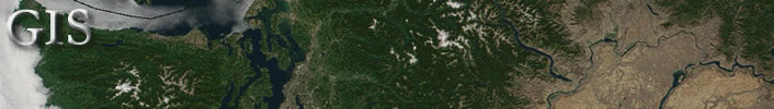
Explore cartography for land management with free data and software on the Internet.

Basic Map Data
Find and explore information used to make digital maps.
Mapping Toolbox
Creative programs to view and adjust cartographic data and to make maps.
GIS Overview If you routinely use maps and databases for decision making, however, you might want to buy commercial Geographic Information System (GIS) software.
2D Maps
Make simple map drawings or complex, georeferenced maps with multiple layers.
3D Maps
Create three dimensional maps from 2D data.
Links
Quickly locate Internet sites offering free aerial photos, data for maps, software and other resources.
Discovering GPS
Curious about GPS? Learn how GPS can locate points and tracks to enhance digital maps.

This page, based from Paul Pingrey's Digital Grove (http://www.digitalgrove.net), offers simple, practical information about digital cartography. The only required investment for the tools and techniques offered above is curiosity and a little time. They might be all you need to create the maps you want or serve as an introduction to more serious study.

 
School of Environmental and Forest Sciences
USDA Forest Service State & Private Forestry
WSU Cooperative Extension
The Rural Technology Home Page is provided by the College of Forest Resources. For more information, please contact the Rural Technology Initiative, University of Washington Box 352100 Seattle, WA 98195, (206) 543-0827. © 2000-2004, University of Washington, Rural Technology Initiative, including all photographs and images unless otherwise noted. To view the www.ruraltech.org privacy policy, click here.
Last Updated 10/13/2022 12:33:47 PM