Tools and Tutorials
No need to spend a
bundle on software for making your own maps. The free programs
listed here can keep you engaged for months and may be all you
need for projects. For additional functionality, the reGIStration
fees for many of the programs are economical. When you are ready,
trials of mainstream professional programs from companies like
Adobe,
ESRI, MapInfo,
MapTech
and many
others are interesting, too.
|


|
- Quantitative
Decisions - Provides a list of ArcView extensions and
information.
- ForestPal - this page
will stimulate interest and provide enough details for you
to begin making your own maps.
- Global
Mapper™ - All-round map viewer, data converter,
measurement tool and more.
- fGIS
- A remarkable, free GIS digitizer and shapefile editing
program and GIS viewer for Windows® from the University
of Wisconsin and Wisconsin DNR - Division of Forestry.
- USAPhotoMaps™/BigJPEG
- Automatically retrieve and mosaic multiple aerial photos
from TerraServer; display and transfer GPS waypoints to
and from GPS receivers.
- OCAD®
- Computer Assisted Cartography program that creates geospatial
vector drawings over aerial photographs.
- Convert
- A freeware distance, area, volume, etc. conversion program.
- AutoRealm
or SourceForge
- Free map drawing program.
- Mapping
Symbol Fonts
- Map
Maker Gratis™ - Free GIS/geospatial mapping program.
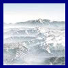
- 3DEM™:
Free program to create 3D maps.
- Natural
Resources Database - (NRDB) creates thematic maps by
linking tabular and spatial data
- Zoner
Draw 3™ or Zoner
Draw at ZDNet - Free drawing program used to make maps.
- ArcExplorer®
2 - Free ESRI viewer for GIS data.
- MrSid
GeoViewer® - Free viewer for images in the MrSID
data compression format.
- ER
Viewer® - Free GIS image viewer.
- ERDAS
ViewFinder® - Free GIS image viewer.
- HGIS®
GPS mapping software from StarPal, Inc.
- G7toWin
and G7toCE - manage GPS waypoint, track and route files
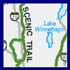
- OziExplorer™
- Mapping program to use with GPS units.
- SurGe
- Gridding and Mapping Software for producing maps of data
- Trimble®
offers free GPS planning software that determines the
visibility of GPS satellites
- TatukGIS®
- Free Projection and Datum Coordinate Converter and the
Aerial Imagery Corrector trial for rectifying aerial photos.
- Surfer®
- Trial of a program for 3D map and contour production.
- OpenOffice™
- Free, all-round office suite, including an excellent vector
drawing program for making maps.
- GIMP™
- Free image/photo editing program.
- Gadwin
Print Screen™ - Free screen capture program.
- UltimateZip
- File archive extractor.
- There are many other free mapping tools not listed here.
Grime:
GIS Tools maintains an extensive list of additional
software and explains the file formats used by GIS and imaging
programs.
|
 Data
and Metadata
There is a wealth of
free data available on the Internet, but be realistic about what
you try to download. If you have an ordinary analog dial-up modem,
you will be less frustrated by using small data sets. For example,
Digital Line Graph (DLG) files showing roads and streams or 30-meter
resolution Digital Elevation Models (DEM) are often only 200-300KB
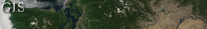
in size, which are easy to download. Single TerraServer aerial photos
will generally load well with a standard modem link. USGS topographic
maps (DRG files) are about 2MB in size. Landsat images and Space
Shuttle Radar DEM files are typically 30MB and larger, requiring
a broadband connection. In addition to free data, many of the following
sources offer inexpensive commercial data.
|
|
Data -
- Need the latitude/longitude of a location to begin
your data search? Check here:
- TerraServer®
- Aerial Photos and Topographic Maps. Use the program USAPhotoMaps
(under Tools, below) to simplify downloads
from TerraServer.
- USGS
Seamless Data Distribution Center - Uses a Java map-based
interface for selecting free, seamless National Elevation
Data (NED), Shuttle Radar Topography Mission (SRTM), and
National Land Cover Data (NLCD). Rather than downloading
files piecemeal, you outline the area where you want coverage
and the EROS Data Center generates a custom file. This source
is ideal if you have a broadband Internet connection.
- USGS
Geographic Data Download - EROS Data Center (DEM, DLG,
NED shaded relief and other data). Parts of this and the
following site offer text-based File Transfer Protocol (FTP)
downloads that are more modem-friendly. You can use Windows
Explorer procedures to copy a file on an FTP site and then
paste it to a location on your hard drive. An alternative
method is to use an FTP program (such as WS_FTP-LE) to copy
files.
- USGS
FTP Download Site for free DLG Data
- USGS
Mapping Information: Geographic Names Information System
(GNIS) - Contains information about almost 2 million
physical and cultural geographic features in the United
States, referenced by State, county, and geographic coordinates.
- USGS
One Degree (30-meter resolution) Digital Elevation Model
(DEM) data - Click the map that appears to locate and
download data.
- Geology
of the Conterminous United States - At 1:2,500,000 scale
this site gives a digital representation of the 1974 P.B.
King and H.M. Beikman Map.
- MapMart®
- USGS partner offering free 10-meter and 30-meter resolution
DEM data (MapMart has a superb graphical, map-based interface
for finding data. For free data, proceed through the ordering
process to the final download page.)
- ATDI®
- A USGS partner offering free Digital Elevation Model (DEM)
data.
- GeoCommunity™
- Free Digital Line Graph (DLG) and Digital Elevation Model
(DEM) data (Note: If you have a broadband Internet connection,
be aware that GeoCommunity downloads are limited to about
5KB per second unless you purchase a premium account.)
- webGIS
- A source of Digital Elevation Models (DEM), Land Use and
Land Cover (LULC) and Digital Line Graph (DLG) shapefile
data in the Geographic and UTM (mostly NAD27) coordinate
systems.
- CAST
- A Comprehensive Guide to Mostly On-Line and Mostly Free
U.S. Geospatial and Attribute Data by Stephan Pollard, sponsored
by the University of Arkansas Libraries
- Doyle's
US GIS Data Links Web Page
- USGS
listing of free DRG Topographic Maps - Listed by state.
- Washington
State Geospatial Data Archive - Maintained by the University
of Washington Libraries' Map Collection and Cartographic
Information Services, this site is a space to locate geospatial
data for the state of Washington and also contains selected
non-Washington geospatial data sets.
- Washington
State Geospatial Clearinghouse - A node on the NSDI
national network of spatial information servers, this resource
contains the spatial information available for Washington
State.
- Oregon
Geospatial Data Clearinghouse - The OGDC helps to coordinate
GIS activities in the state, facilitates communication about
GIS issues, and maintains the website that hosts statewide
geospatial data for the State of Oregon.
- Shuttle
Radar Topography Mission - Highly detailed Digital Elevation
Models.
- Landsat
Satellite Space Imagery - NASA Earth Science Applications
Directorate (for additional sources of satellite imagery,
see Terrainmap.com.)
- US
Census Data
- Census
2000 Tiger/Line Data - ESRI site with graphical map
interface.
- MapShots,
Inc. - Tiger vector map data in Geographic-WGS84 format
by state and county
- Public
Land Survey Information - Section line and corner information
available in shapefile format for about half the US
- USGS
NED Shaded Relief Imagery Data - ESRI site with graphical
map interface
- United
Nations Environment Program - Worldwide data.
- Canadian
GIS Data
- US
Fish and Wildlife Service - Extensive list of mapping
resources
- OziExplorer™
- Maps Page has links to many map sources around the world.
- Bureau
of Land Management GIS Utilities - A miscellaneous collection
of GIS utilities and some data files.
- Northwest
Regional Ecosystem Office
- Northwest
Regional Ecosystem Office - Columbia River Gorge
- For an extensive list of mapping file formats supported
by Global Mapper and sources for the data, check
here.
Metadata -
|
Map Galleries
Other Useful Sites
GIS Related Jobs
|