 |
 |
 |
 |


Appendix A and B
A: Fremont National Forest Map and Results
B: Okanogan National Forest Map and Results
|
***Return to Investigation of Alternative Fuel Removal Strategies Table of Contents***
Tables
Images
Appendix A: Fremont National Forest Map and Results
Appendix
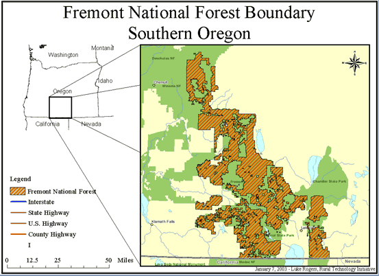
A Fremont National Forest Map and Results
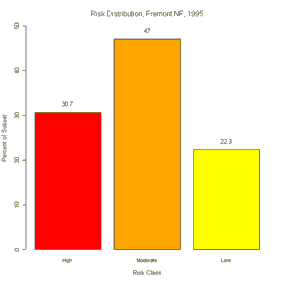
Fremont National Forest Risk Classes
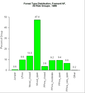
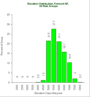
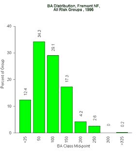
Fremont: Forest type, Elevation, Basal area, QMD
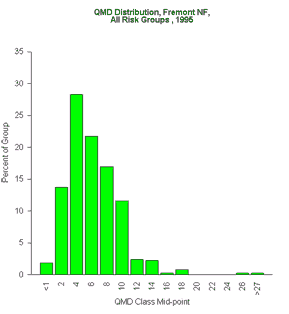
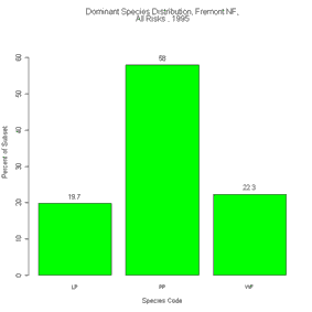
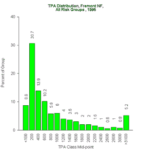
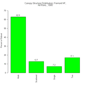
Fremont: Species, TPA, Canopy structure, Fire risk
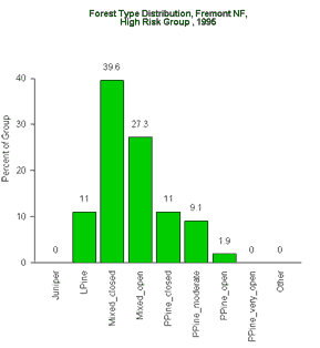
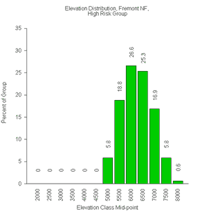
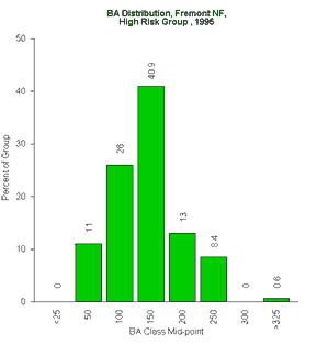
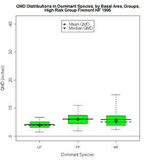
Fremont - High Risk Stands: Forest type, Elevation, Basal area, QMD
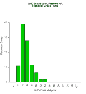
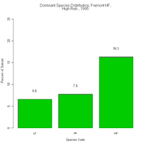
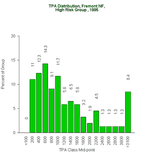
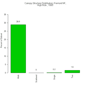
Fremont - High Risk Stands: Species, TPA, Canopy Structure
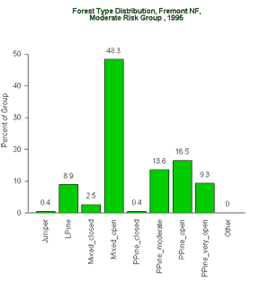
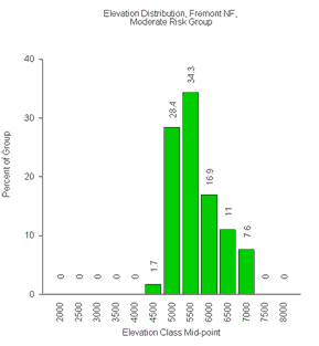
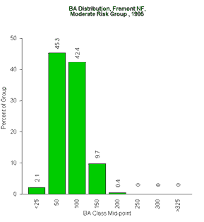
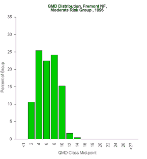
Fremont - Moderate Risk Stands: Forest type, Elevation, Basal area, QMD
Fremont - Moderate Risk Stands: Species, TPA, Canopy Structure
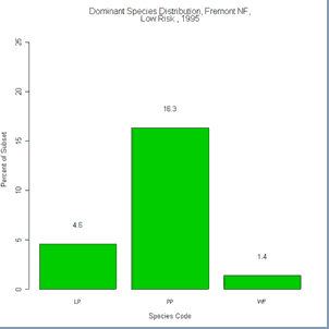
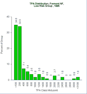
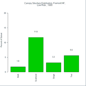
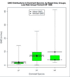
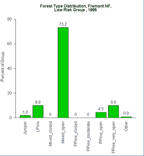
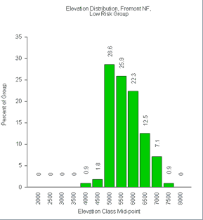
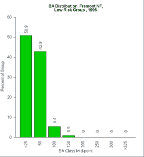
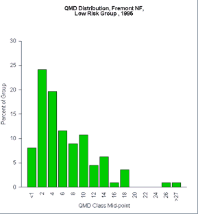
Fremont - Low Risk Stands: Forest type, Elevation, Basal area, QMD
Fremont - Low Risk Stands: Species, TPA, Canopy Structure
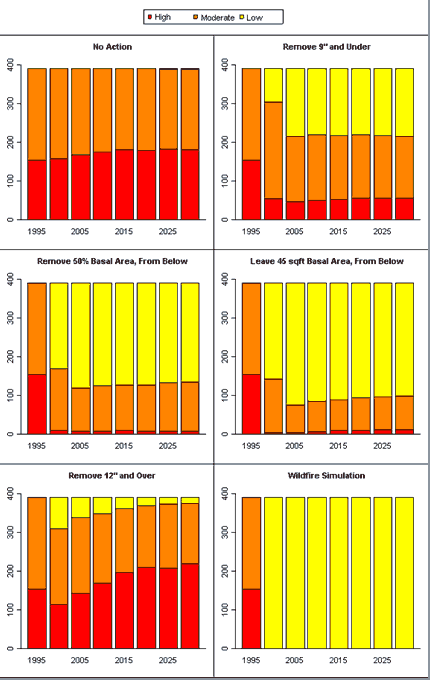
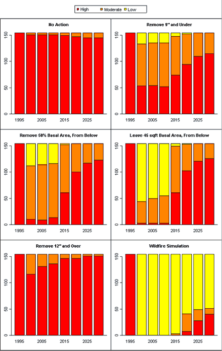
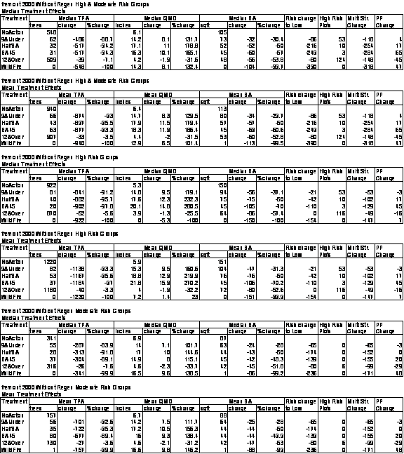
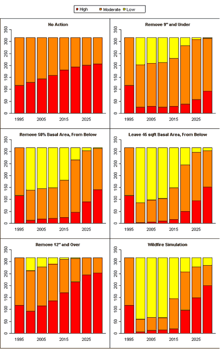
Fremont - High & Moderate Risk Stands: Fire Risk without regeneration
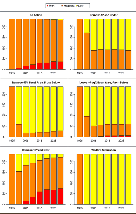
Fremont - High & Moderate Risk Stands: Fire Risk with regeneration
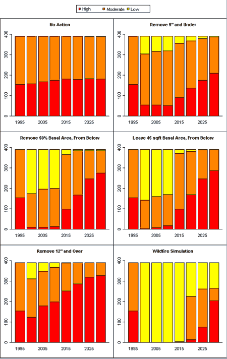
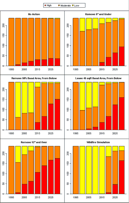
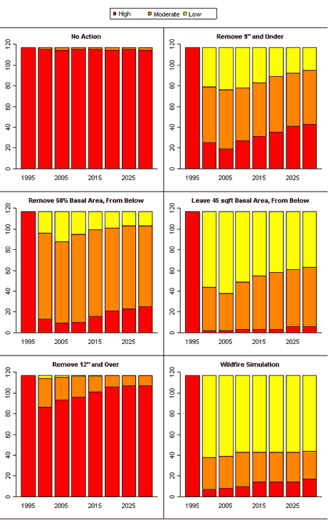
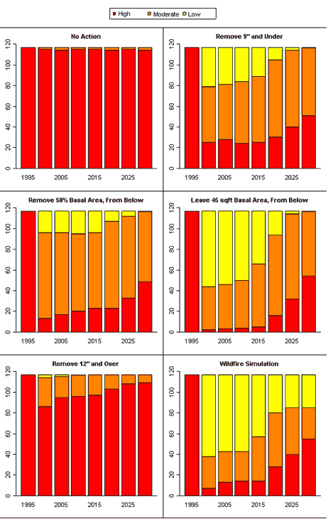
Fremont - High Risk Stands: Fire Risk without regeneration
Fremont - High Risk Stands: Fire Risk with regeneration
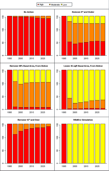
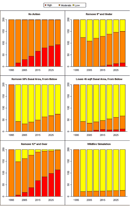
Fremont - Moderate Risk Stands: Fire Risk without regeneration
Fremont - Moderate Risk Stands: Fire Risk with regeneration
Fremont - Fire Risk Reduction Metrics
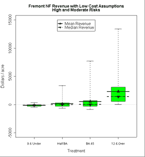
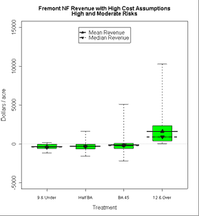
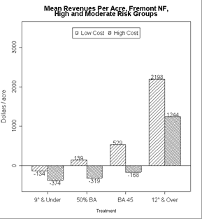
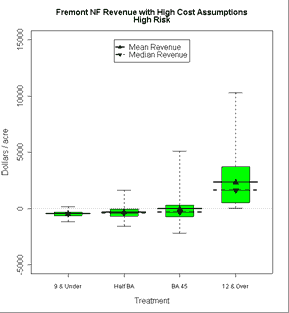
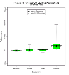
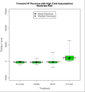
Fremont - High & Moderate Risk Stands: Economics, Low & High Costs
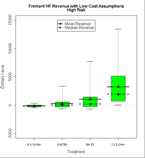
Fremont - High Risk & Moderate Risk Stands: Economics, Low & High Cost
Appendix B: Okanogan National Forest Map and ResultsAppendix B: Okanogan National Forest Map and Results |
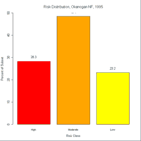
| Risk Class |
Stands
|
Percent
|
| High Risk |
117
|
28.33
|
| Moderate Risk |
200
|
48.43
|
| Low Risk |
96
|
23.24
|
| Total |
413
|
|
![]()
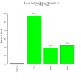
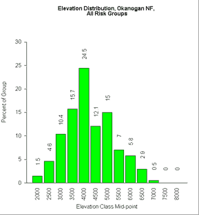
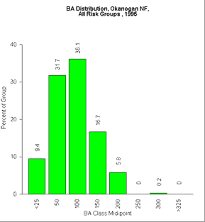
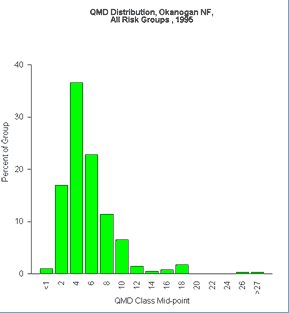
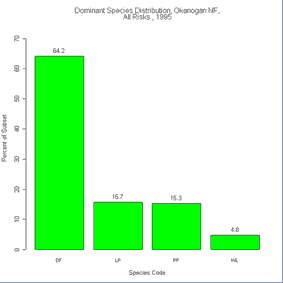
Okanogan: Forest type, Elevation, Basal area, QMD
 |
 |
 |
 |
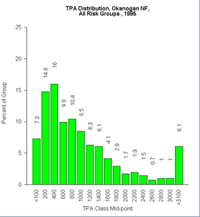
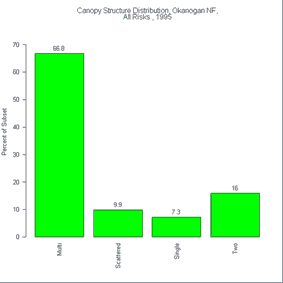
Okanogan: Species, TPA, Canopy structure, Fire risk
 |
 |
 |
 |
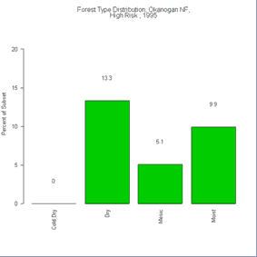
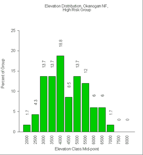
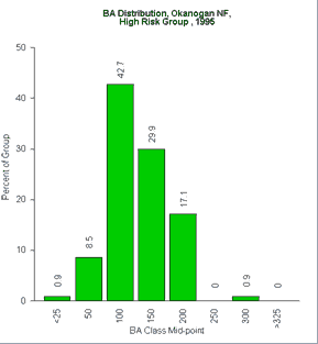
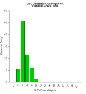
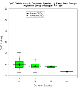
Okanogan - High Risk Stands: Forest type, Elevation, Basal area, QMD
 |
 |
 |
 |
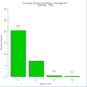
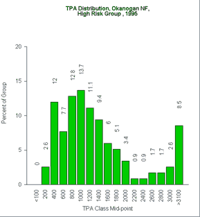
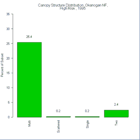
Okanogan - High Risk Stands: Species, TPA, Canopy Structure
 |
 |
 |
 |
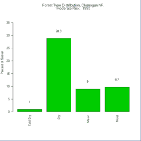
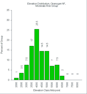
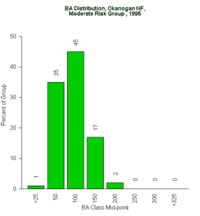
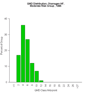
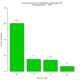
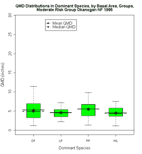
Okanogan - Moderate Risk Stands: Forest type, Elevation, Basal area, QMD
 |
 |
 |
 |
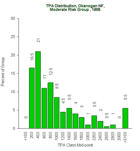
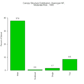
Okanogan - Moderate Risk Stands: Species, TPA, Canopy Structure
 |
 |
 |
 |
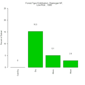
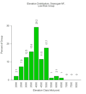
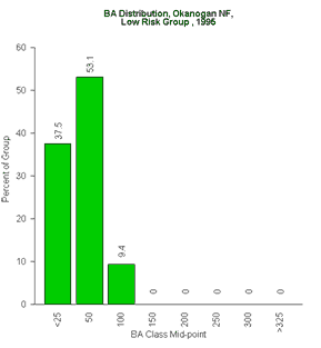
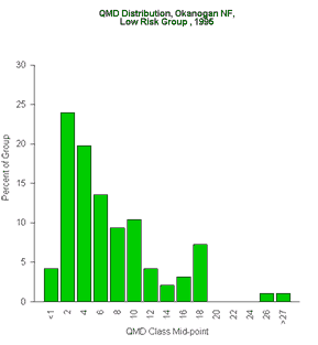
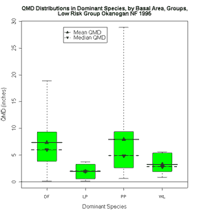
Okanogan - Low Risk Stands: Forest type, Elevation, Basal area, QMD
 |
 |
 |
 |
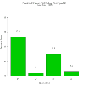
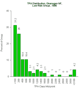
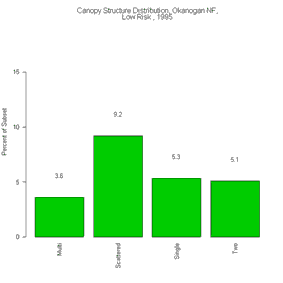
Okanogan - Low Risk Stands: Species, TPA, Canopy Structure
 |
 |
 |
 |
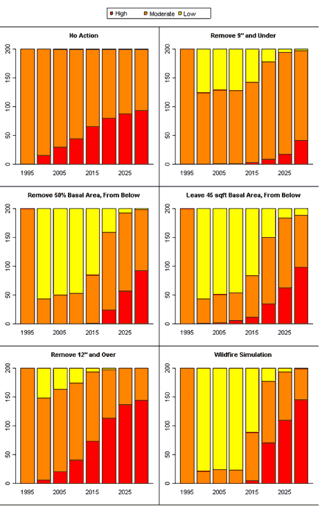
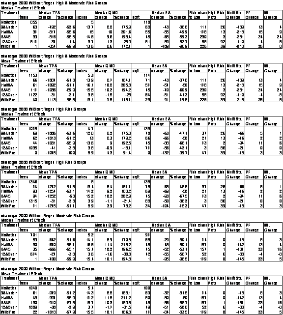
Okanogan - High & Moderate Risk Stands: Fire Risk without regeneration
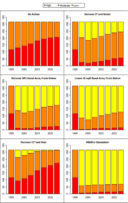
Okanogan - High & Moderate Risk Stands: Fire Risk with regeneration
Okanogan - High Risk Stands: Fire Risk without regeneration
Okanogan - High Risk Stands: Fire Risk with regeneration
Okanogan - Moderate Risk Stands: Fire Risk without regeneration
Okanogan - Moderate Risk Stands: Fire Risk with regeneration
Okanogan - Fire Risk Reduction Metrics
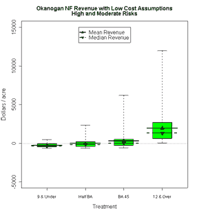
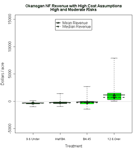
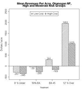
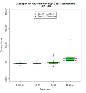
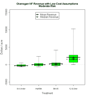
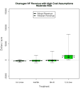
Okanogan - High & Moderate Risk Stands: Economics, Low & High Cost
 |
 |
 |
Okanogan - High Risk & Moderate Risk Stands: Economics, Low & High Cost
 |
 |
 |
 |

