|
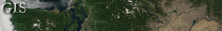
Global Mapper, ArcExplorer and many Internet map applications are
excellent for looking at geographic data. With their ability to
turn layers on/off, such programs can be used to analyze information
and make base maps. If you want to add your own original data or
annotations, however, you will need to use a program designed for
that purpose.
There are three basic alternatives for adding your own thematic
data to maps:
- Drawing programs (e.g., AutoREALM™,
Zoner
Draw®, Paint Shop Pro®, Adobe Illustrator®,
Macromedia FreeHand®, etc.)
- Computer Aided Design and Drafting programs (like OCAD®,
CC2 Pro®, AutoDesk Map®, etc.)
- Geographic Information System programs (e.g., Map
Maker™, Manifold System 5®, ArcMap®, MapInfo®,
etc.)
 |
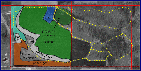
All three types of programs use layers to organize
and protect information. The above Zoner Draw example has five
layers: aerial photo background, public land survey lines, forest
cover type, trails and text. Once the thematic vector layers
are finished, the photo background could be made partially transparent
or turned off to simplify the map for printing. Having the data
in vector layers also makes revisions easy. Just go to the target
layer, select an object and change properties of the color,
fill, line width, line type, etc. |
Drawing programs are generally easy to learn, fast and allow more
creative license in the appearance of a map. Geospatial CAD and
GIS programs are technically precise, allowing real-world positioning
and measurement. You might elect to use a combination of programs
to make maps, starting in one and moving to one of the others for
the final presentation as professional cartographers do.
You are encouraged to try Auto
Realm and Zoner
Draw if you don't already have a favorite drawing program. They
are fun to work with, especially if you download some of the additional
mapping symbol fonts available on the Internet.
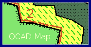 |
Most CADD programs have a reputation
for being difficult to use, but you'll find OCAD
to be a notable exception. It's designed specifically for cartography
and works with simple graphical tools rather than complex commands.
OCAD 8's advantage over drawing programs like Zoner Draw is
that it can be set to work in a geospatial mode, allowing measurement
of lines and areas and export of maps to GIS programs. |
| OCAD also has snap-alignment features
that you won't find in simple drawing programs, making it possible
to draw polygons and roads without overlap or voids. Unlike
GIS programs, however, the basic version of OCAD is not designed
for analysis of geospatial data. |
Map
Maker Gratis is a powerful geospatial mapping/GIS program and
learning tool. Create your own polygons, lines, points and text
and save them to layers. Edit the objects. Use the Query tool to
read the area and perimeter of polygons, the length of lines or
to analyze data associated with an object. The ability to associate
data or other files (such as photos or notes) to map objects is
the most distinguishing feature between GIS programs like Gratis
and simpler drawing or CAD programs.
 |
Be sure to download the Map
Maker Manual. Its sixteen chapters are an excellent reference
about digital mapping, explaining many concepts in clear language.
The Map Maker manual will be useful whether you stick with Map
Maker Gratis, move up to Map Maker Pro or work with other professional
GIS programs such as Manifold,
ArcView,
MapInfo
or others. |
|