Example Maps from the 2007 Washington State Forestland Database
Resolution/Size: 300 dpi / 11" x 8.5"
Image Format: PNG (Portable Network Graphics) |
Title |
Link |
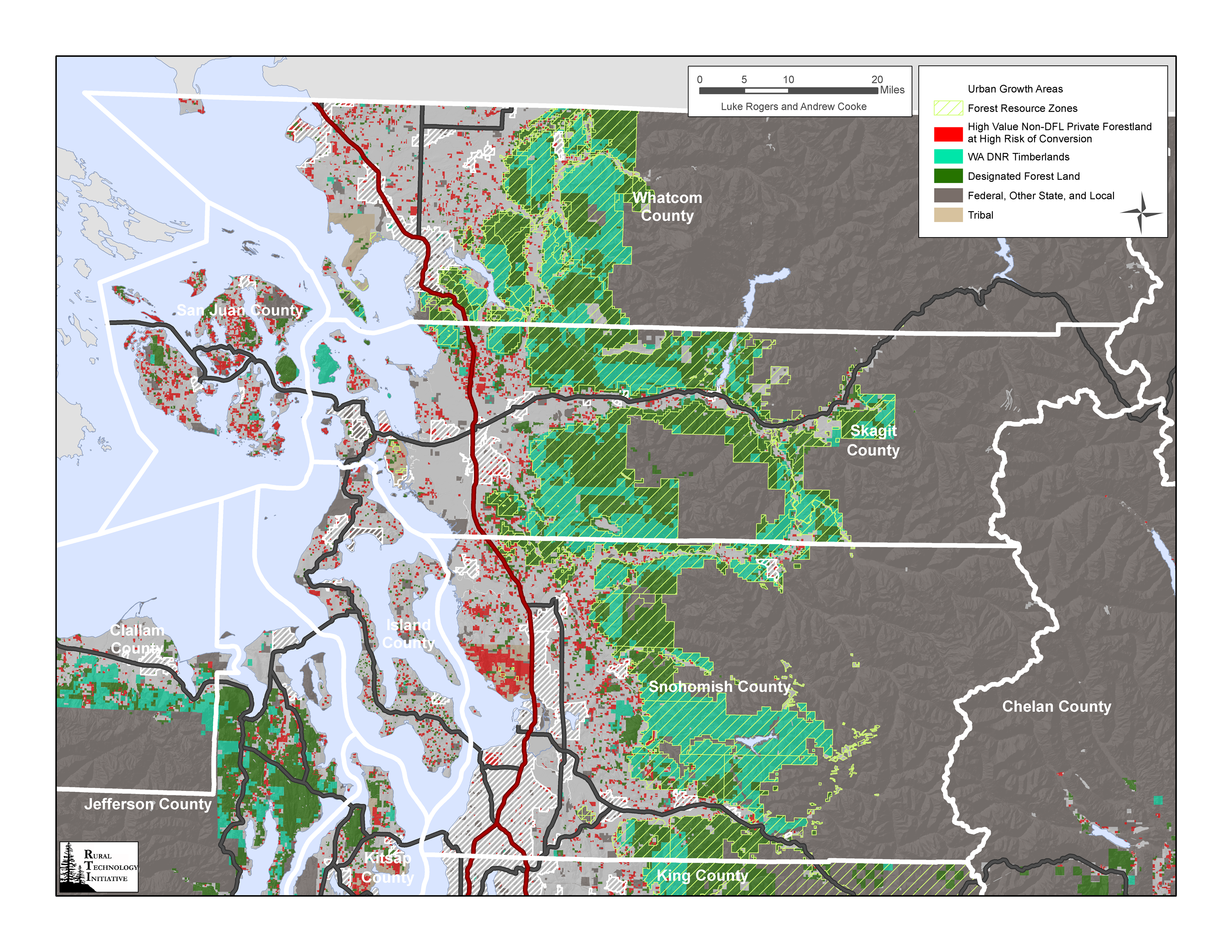
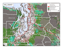
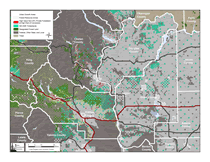
Detail Maps of High Conversion Risk, High Value Private Forestland Near
Anchor Forests in Washington
- North Puget/Islands |
 |
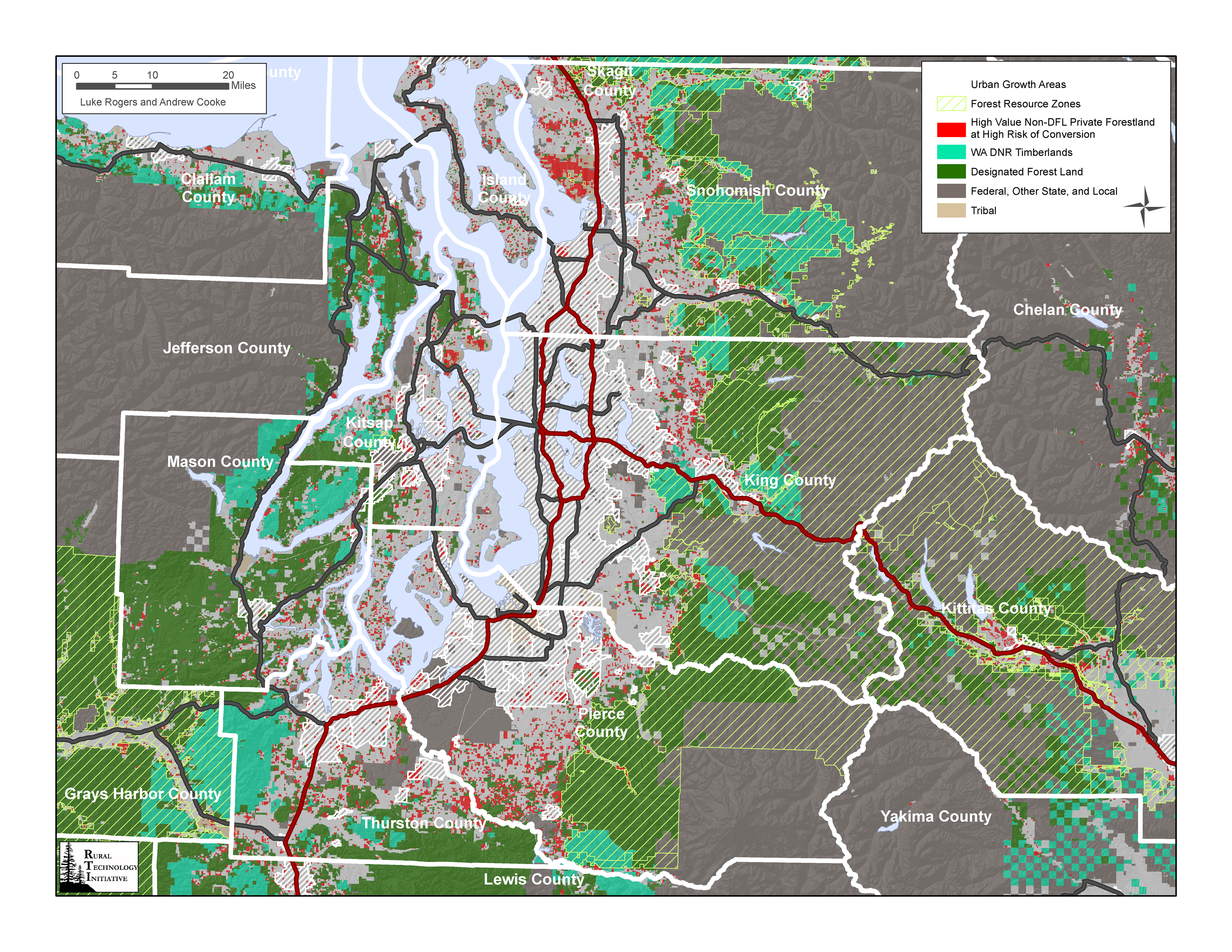
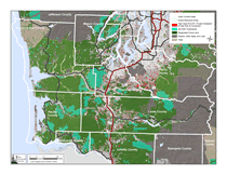
Detail Maps of High Conversion Risk, High Value Private Forestland Near
Anchor Forests in Washington
- South Puget/Hood Canal |
 |
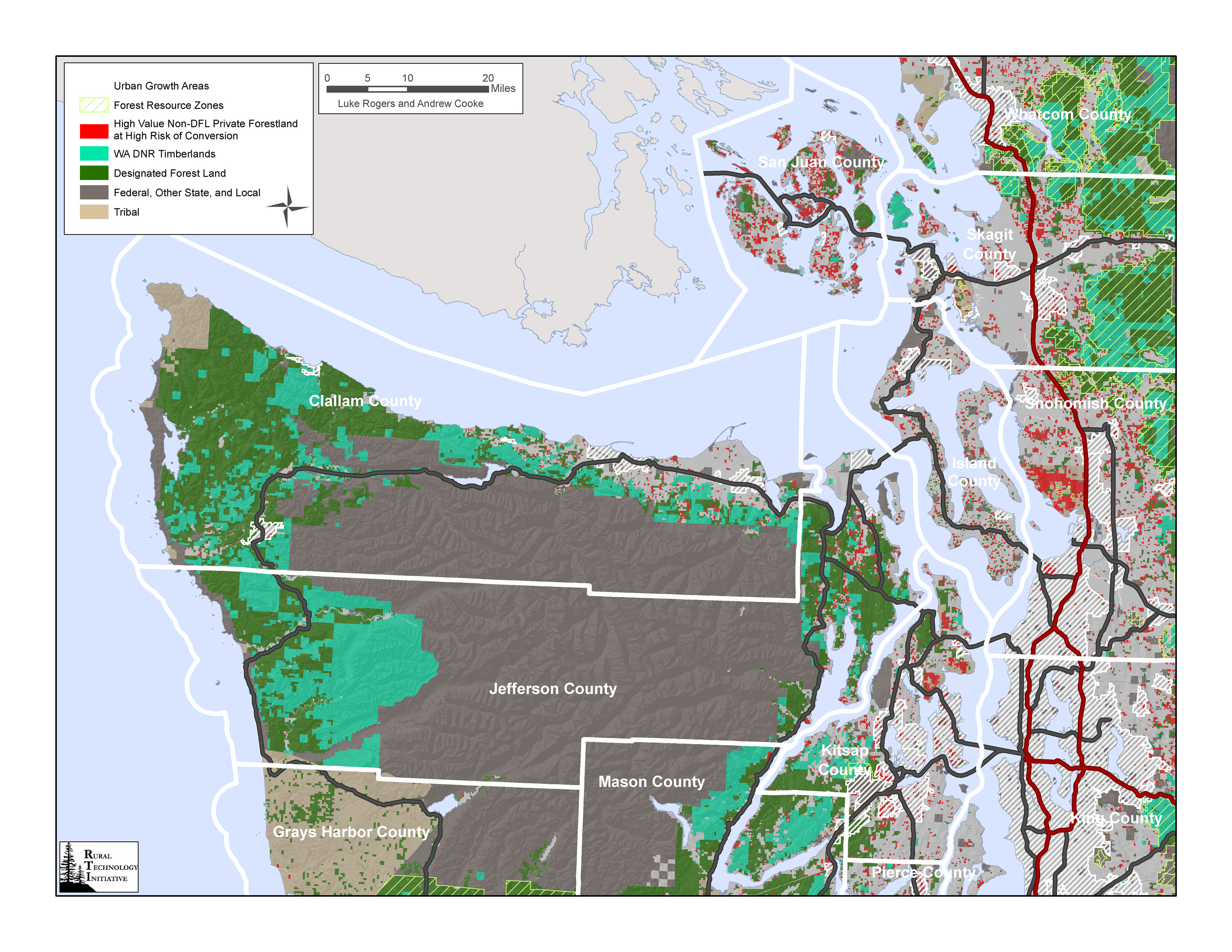
Detail Maps of High Conversion Risk, High Value Private Forestland Near
Anchor Forests in Washington
- Olympic |
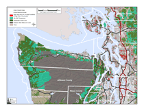 |
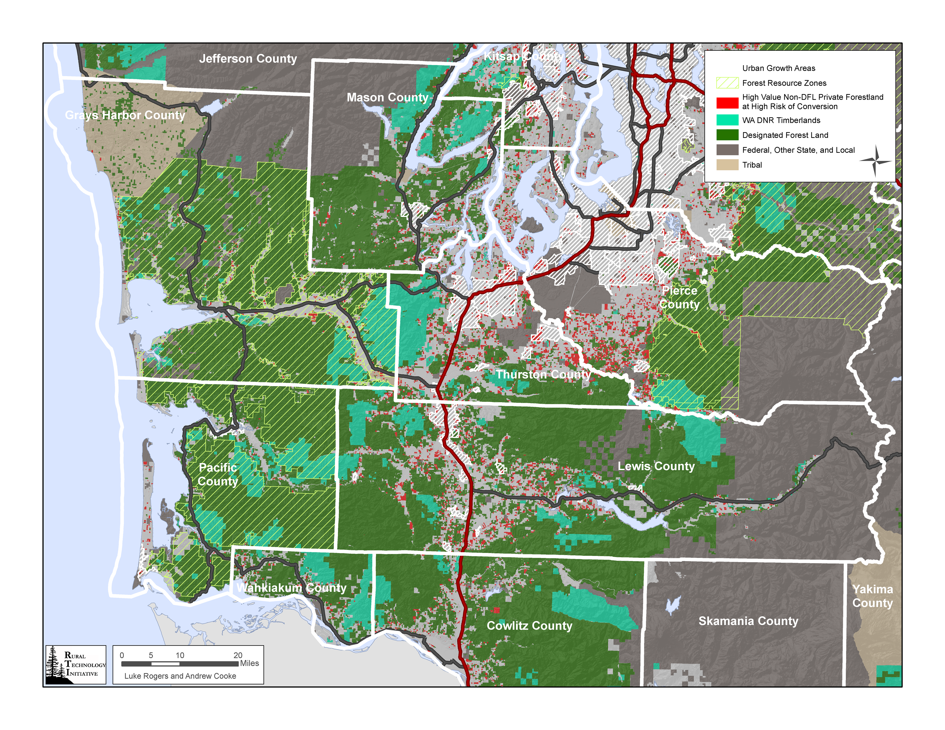
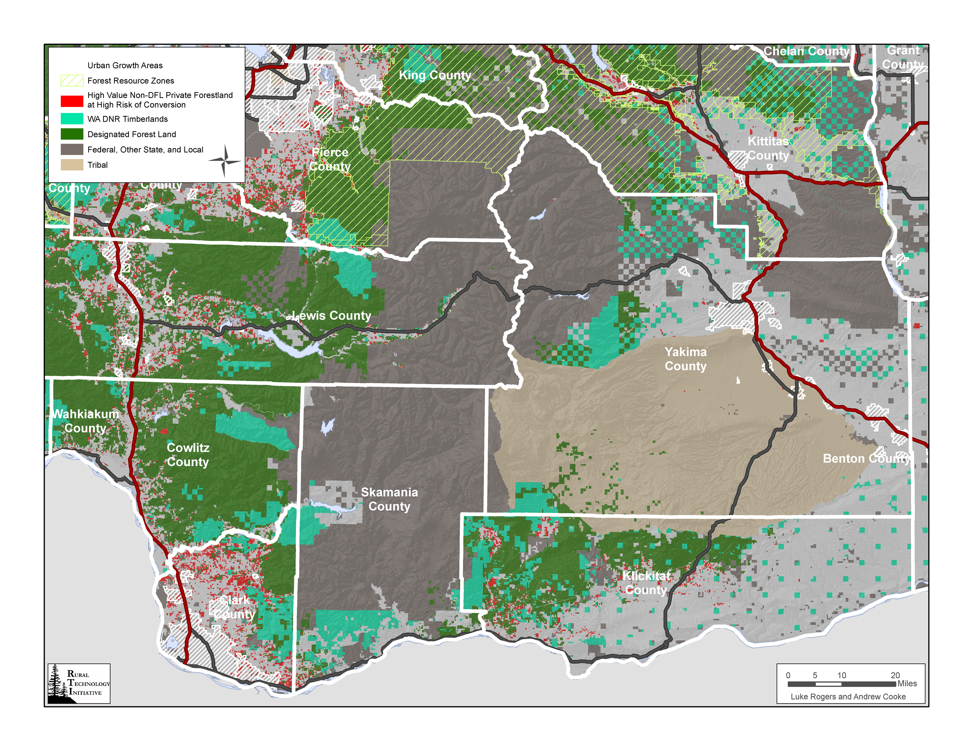
Detail Maps of High Conversion Risk, High Value Private Forestland Near
Anchor Forests in Washington
- Southwest |
 |
Detail Maps of High Conversion Risk, High Value Private Forestland Near
Anchor Forests in Washington
- East Cascades/SW |
 |
Detail Maps of High Conversion Risk, High Value Private Forestland Near
Anchor Forests in Washington
- East Cascades/Central |
 |
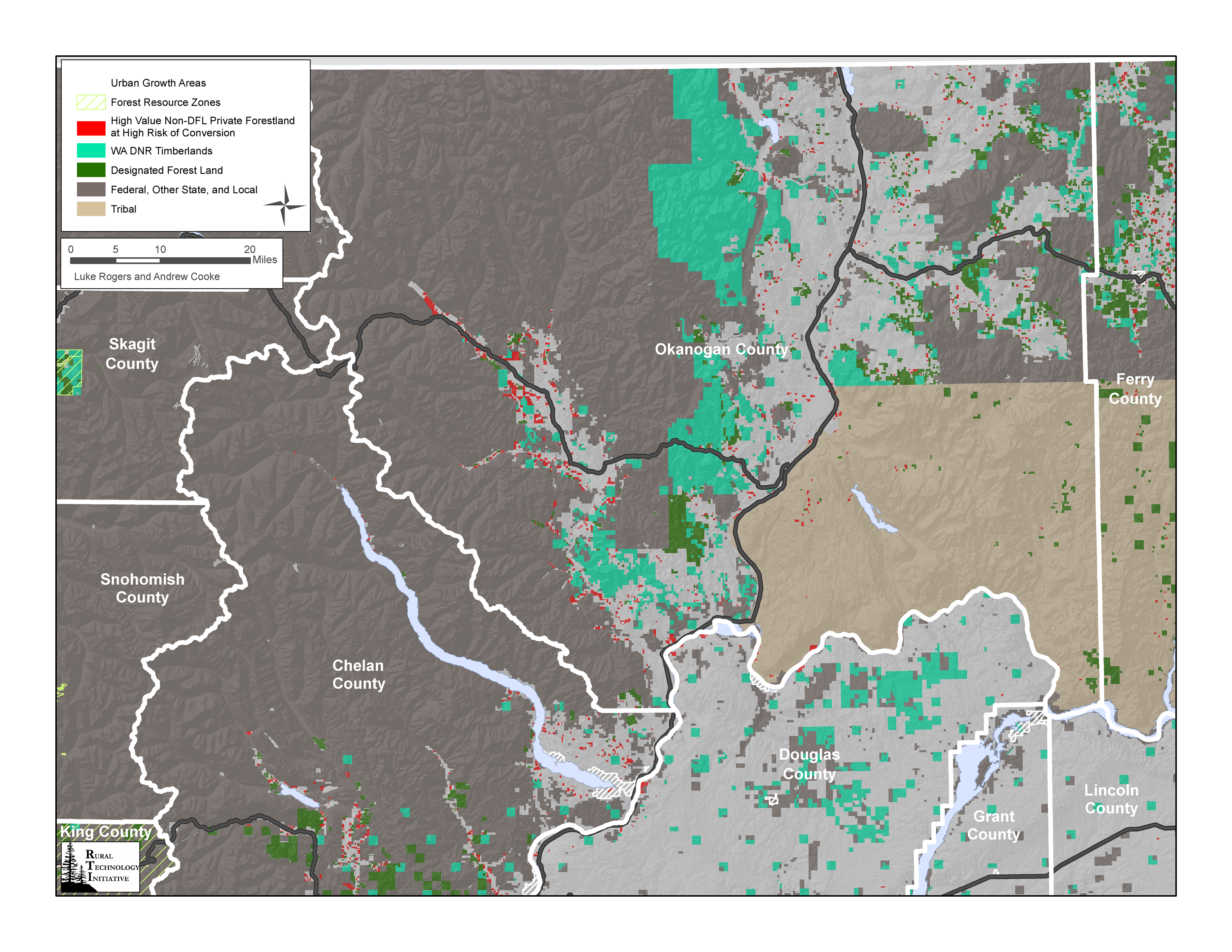
Detail Maps of High Conversion Risk, High Value Private Forestland Near
Anchor Forests in Washington
- North Central |
 |
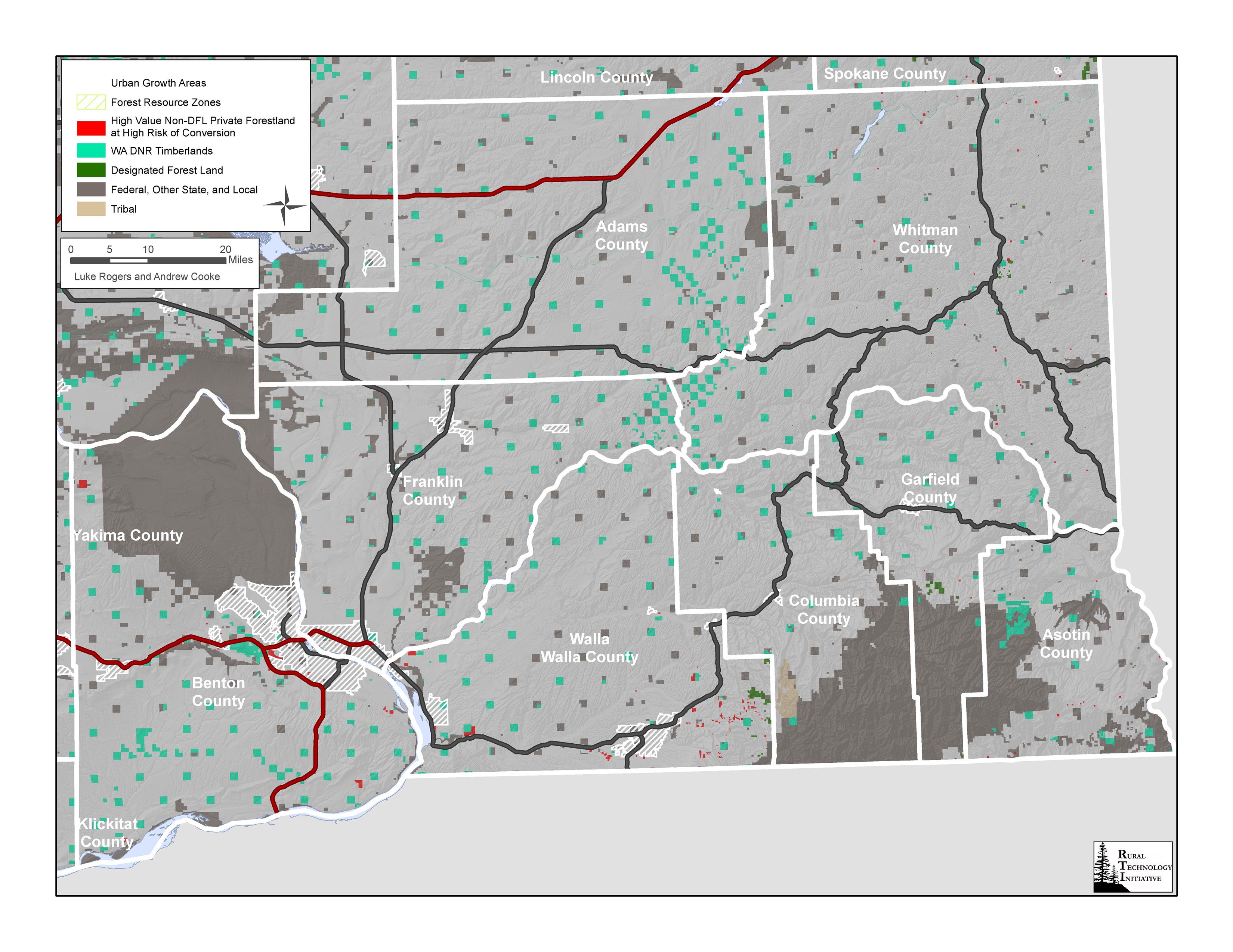
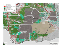
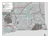
Detail Maps of High Conversion Risk, High Value Private Forestland Near
Anchor Forests in Washington
- Southeast |
 |
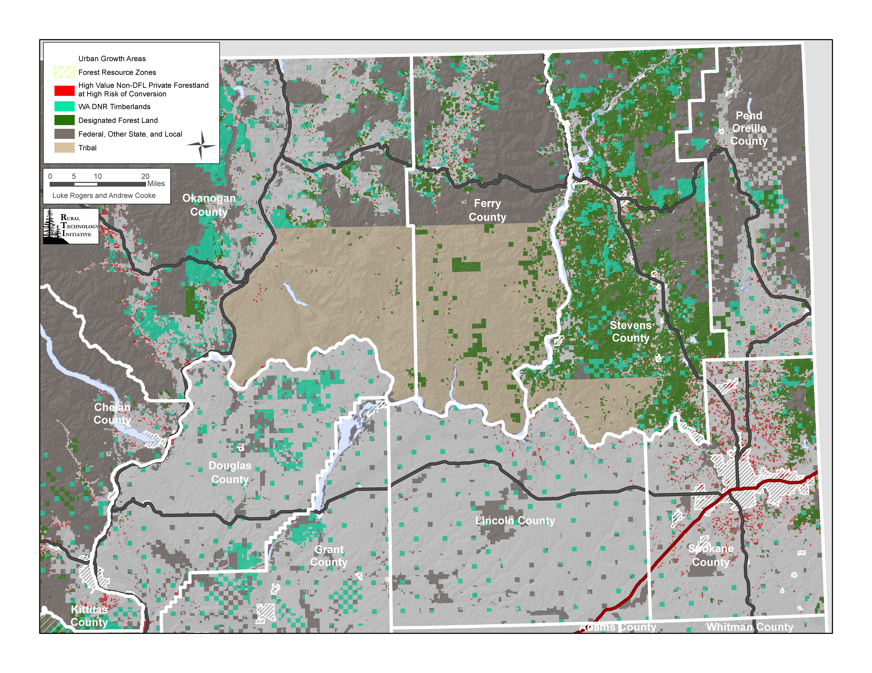
Detail Maps of High Conversion Risk, High Value Private Forestland Near
Anchor Forests in Washington
- Northeast |
 |
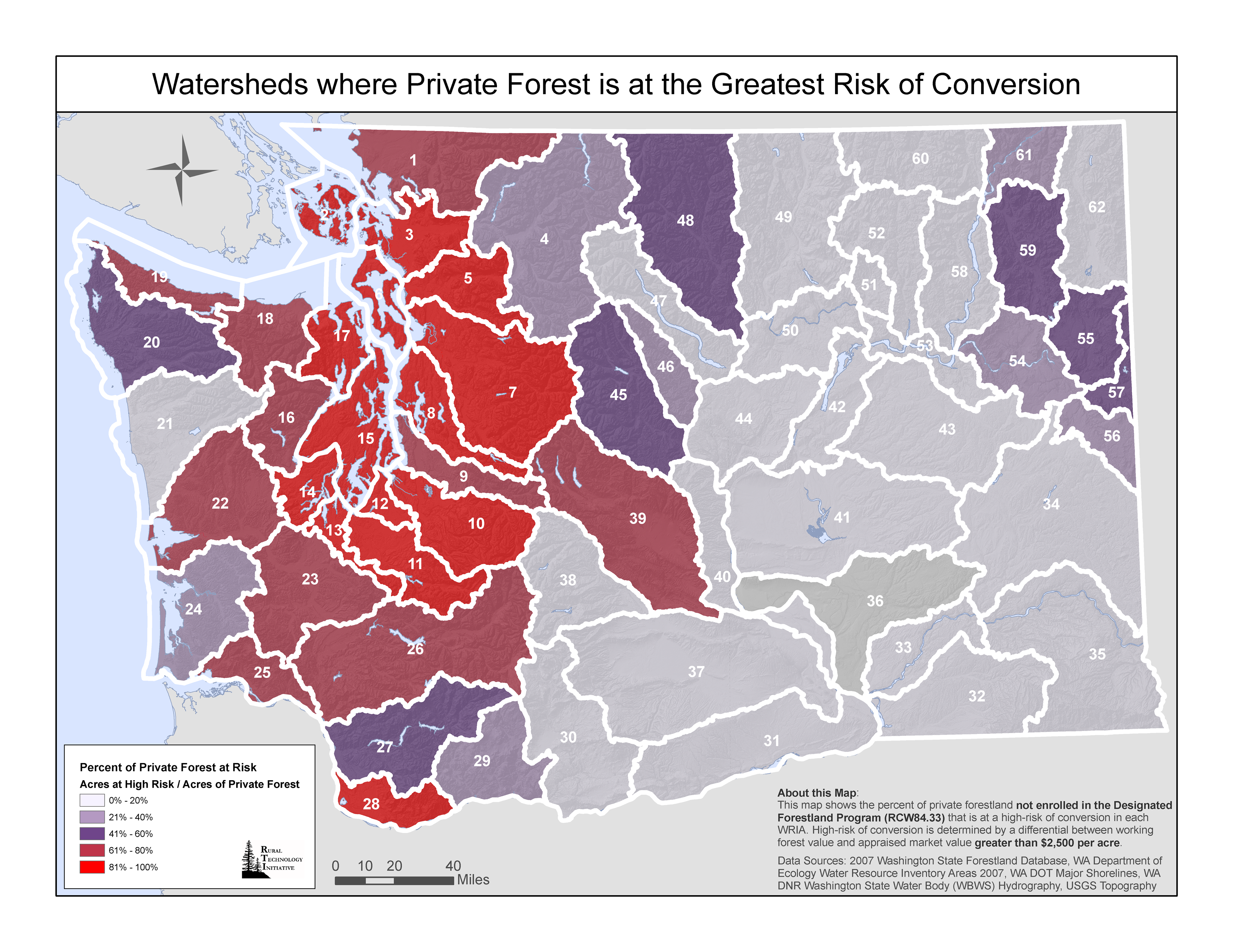
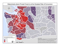
| Watersheds where Private Forests are at the Greatest Risk of Conversion |
 |
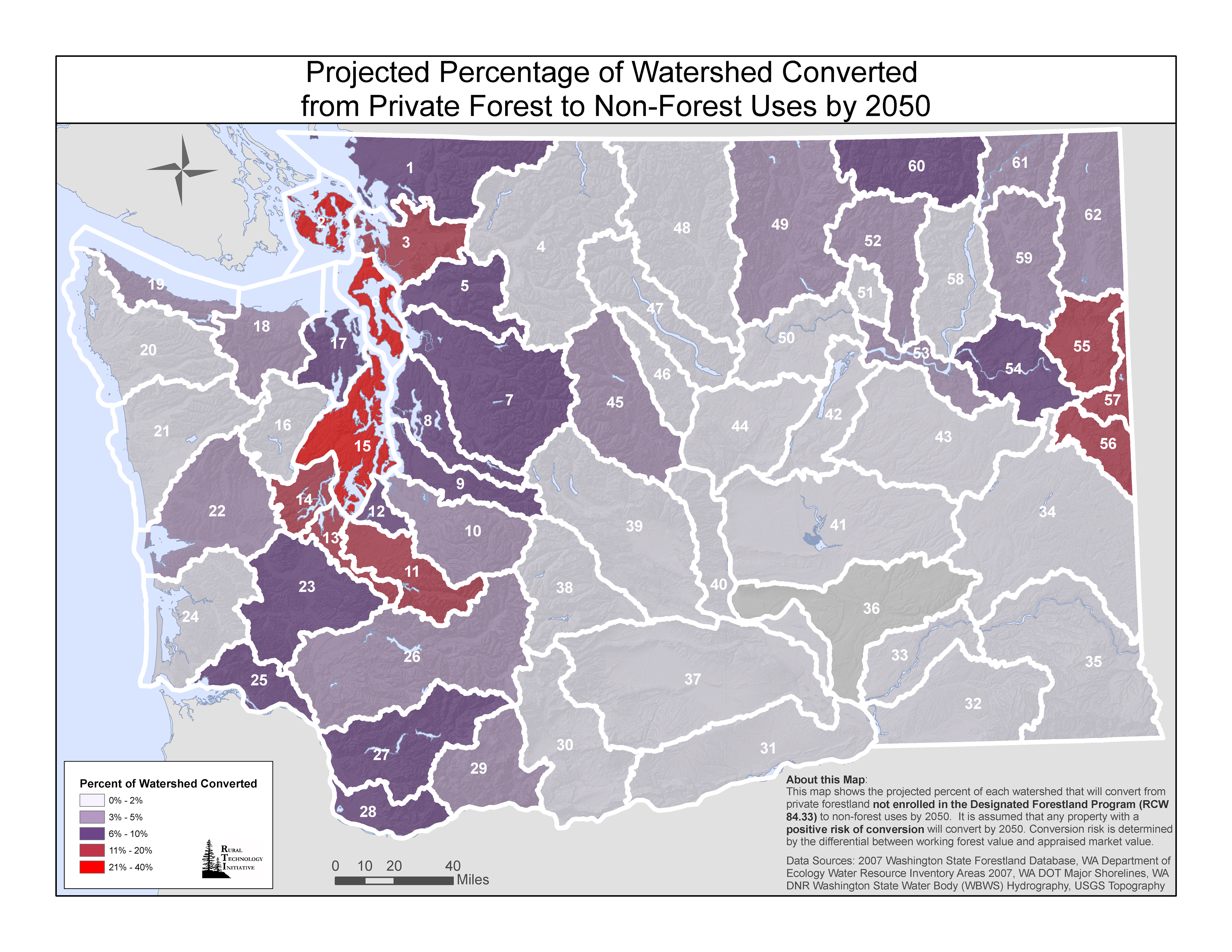
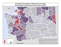
| Projected Percentage of Watersheds Converted from Private Forest to Non-Forest Uses by 2050 |
 |
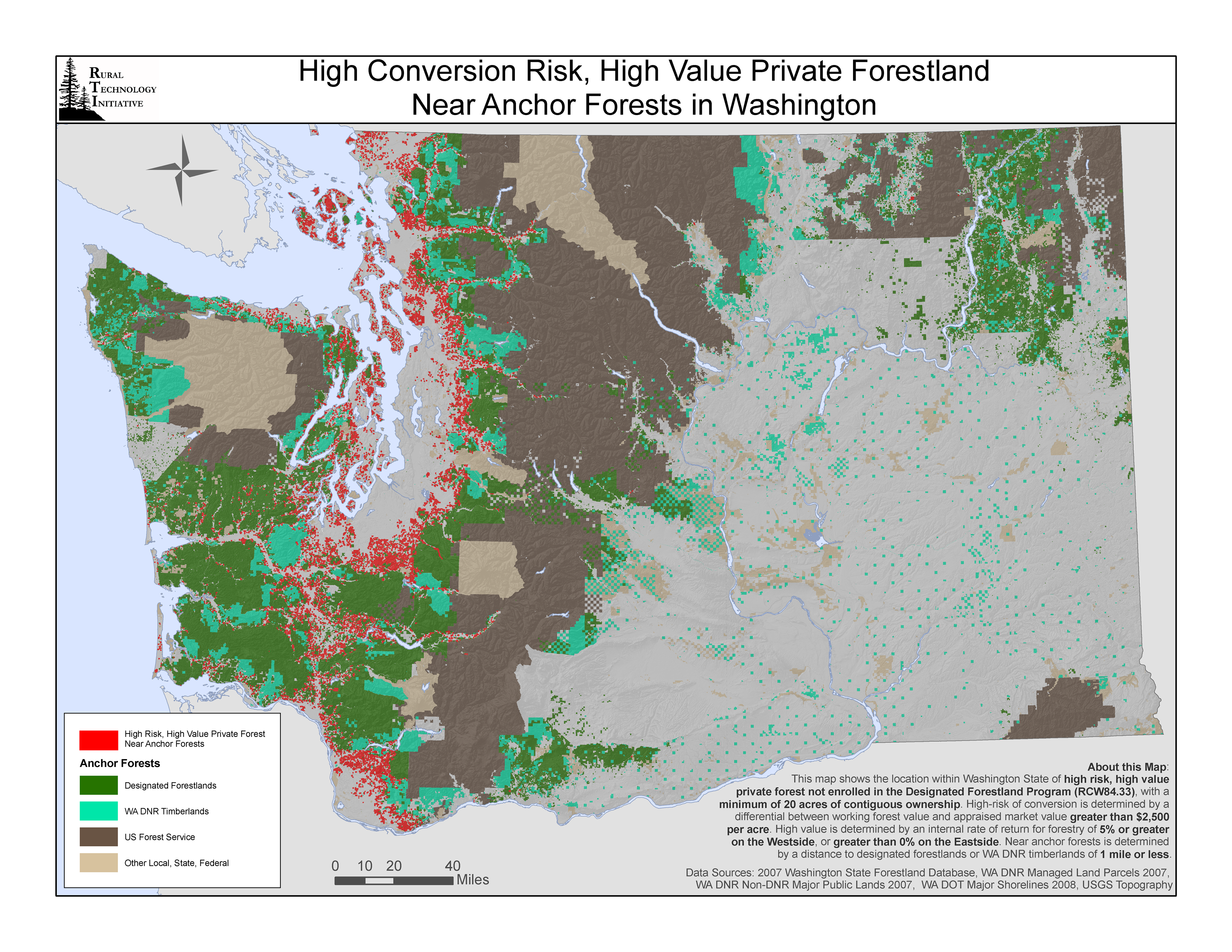
| High Conversion Risk, High Value Private Forestland Near Anchor Forests in Washington |
 |