Scope of Work for Forest Management Assessment and Planning
Strategy
The objective of this agreement is to provide Bremerton
Public Works & Utilities (PW&U) with accurate forest
stand information to maximize water protection, revenue production,
and water production within the specified constraints for
the duration of the planning period. Primary constraints
include, but are not limited to: Surface Water Treatment
Rule (SWTR); Forest Practices Regulations; and sustained
yield harvest principals. This information is intended to
update and supplement constraints and information contained
in the December 1996 Utility and Forest Land Management Plans.
Abstract
The objective of the attached proposal is to
provide Bremerton Public Works and Utilities (PW&U) with
accurate forest stand information to best manage the forest
resource on a sustainable basis for water protection, revenue
production, and water production within specified constraints
into the future. The University of Washington, College of
Forest Resources, Rural Technology Initiative (RTI) will
use forest inventory, geographical, historical, and other
information as data inputs for the Landscape Management System
(LMS©), a publicly available forestry software program,
and ArcView©, a proprietary Geographical Information System
(GIS)
program, in collaboration with the PW&U Forestry Division
and other consultants, to create an assessment of current
and future conditions on Water Utility forestlands under
different management approaches. Alternative approaches to
meeting the multiple-use goals of PW&U for these forestlands
will be developed and evaluated on a temporal and spatial
basis using a combination of ecological and economic models.
A report on comparisons of alternate management approaches
will result and be provided to PW&U. The report will
include estimates of sustainable harvest volumes as well
as other pertinent metrics of forest resource analysis associated
with PW&U management goals. RTI will also train PW&U
personnel in the use of LMS and provide the PW&U Forester
copies of the LMS software as well as electronic versions
of all data and mapping capabilities generated from this
project. The planning horizon will be 50 years developed
in 5-year management cycles.
Background
The Bremerton Water Utility owns 8,186 acres
of land in Kitsap County that were originally purchased and
are managed to protect and enhance the water quality and
resource for public water supply. Most of this Water Utility
land is located within the contiguous ownership of 7,660
acres. The major drainages within these lands are the Union
River, and Gorst Creek. The City prepared a comprehensive
Plan to manage these lands in 1986 and an update to the Plan
in 1996. As part of the 1996 planning effort, a field inventory
of forest resources was conducted and digital mapping capability,
through the use of GIS, was established. An examination of
the 1996 field inventory data indicates that the Utility
has 7,108 acres of land in forest. The soils and climate
are conducive to production of timber resources. In 1996,
the average site index from King Site Index (King, 1966)
was determined to be 106, which is a medium site class III.
The slope of the land ranges from 0 to 60% with predominant
south and southwest facing slopes.
Of paramount concern to the City of Bremerton PW&U is
the continued high quality of its surface water resources.
The Water Utility operates the Union River Reservoir as an
unfiltered surface water supply that provides for 60% of
customer water use. The remaining 40% is taken from 12 wells
located on Utility lands outside of the Union River Basin.
To continue to operate as an unfiltered source, the Water
Utility must maintain source water quality as defined by
a number of state and federal regulations. In 1996, the Utility
Land Management Plan estimated, that if water quality declined
below required surface water standards, the PW&U could
be required under law to build a filtration plant. The estimated
costs of a filtration plant at that time were $12 million
for construction and $1.3 million annually in operation and
maintenance costs.
Timber harvest activities provide the PW&U with substantial
revenues ($1-1.5 million annually) that are dedicated primarily
to reduction of Utility operating expenses. The result is
considerable ratepayer savings. Logging activities conducted
in the Union River Basin, however, may be limited to insure
adequate protection of the unfiltered status of the Union
River water source.
The forest management term used most often to refer to an
individual management unit or area is stand. Forest stands
may be as small as less than an acre or as big as several
hundred acres. For GIS purposes, stands may be referred to
as polygons. When developing management plans for forested
landscapes, the characteristics of multiple stands must be
considered.
The majority of the forestland base is covered with second
growth forest (96%) with an average age of 50 years. These
forests were naturally regenerated as a result of a combination
of logging and fire activity. Douglas-fir is the dominant
tree species present accounting for 79% of the inventory.
The remaining tree species are western hemlock (11%), red
alder (7%), big leaf maple (2%), western red cedar (1%),
and a small component of western white pine and black cottonwood.
For many years, laminated root disease, which attacks Douglas-fir
trees, was found to be a problem throughout the utility
lands. Since the writing of the 1996 Plan, the major thrust
of forest harvest activities has been the removal of trees
(primarily Douglas-fir) from areas infected by root rot.
Species, such as red cedar, western white pine, western
hemlock, and alder that are resistant to root disease,
were propogated in harvested root rot pockets. Today much
of the root rot infestation has been controlled.
Since 1996, substantial changes to the Forest Practices
Regulations of Washington State have been made to protect
native fish and water quality. The current regulations are
referred to as the Forest and Fish Rules. Regulatory changes
include new protocols for stream typing and riparian buffer
delineations. As a result of these new regulations, a larger
portion of the forest area within Utility owned forests,
than was expected in 1996, could be unavailable for timber
harvest. Other protected species can also impact availability
of stands for harvest.
As the forest becomes older, larger portions of the forests
will need to be scheduled for final harvest and regeneration.
The scheduling and location of such harvest activities may
be sensitive to a wide assortment of issues including impacts
to surface water turbidity and impacts to viewscapes.
The 58,000 residents that are served by the City of Bremerton
Water Utility enjoy the benefits of unfiltered clean water
delivered to their homes at rates well below what neighboring
community water customers are required to pay. Receipts from
the sale of forest products have historically generated $1-1.5
million annually in fiscal return to the Water Utility. These
revenues are primarily used to reduce expenses for the water
system and lessen the level of user rate increases. Presently
most of the forest is mature; a strategy to broaden the distribution
of ages classes and species mixtures may be desirable to
help insure a future sustainable flow of revenues from harvest
activities.
Because of the above-mentioned issues and other challenges
to forest management such as maintenance of sites for biosolids
applications and reservoir/intake protection areas, there
is need for PW&U to reassess and update forest resource
planning. Developments in technology will be helpful to such
a process.
Objective
The objective is to provide PW&U with accurate
forest stand information and alternative landscape management
plans to maximize water protection, revenue production, and
water production within specified constraints for the duration
of the planning period.
Management of forest resources under variable
and sometimes conflicting objectives has become complex and
problematic.
At the University of Washington, College of Forest Resources,
there is a program designed to utilize the latest science
and best technology to assist forest managers and decision
makers in the creation of forest plans. This program is
called the Rural Technology Initiative (RTI).
RTI has assembled a team of professional scientists,
staff, and graduate students to utilize and develop software-modeling
capabilities in support of problem solving for complicated
natural resource management challenges. Software capabilities
include the Landscape Management System (LMS), a publicly
available forestry software package developed at the UW.
LMS utilizes forest inventory data and GIS layers to create
a virtual model of the forest landscape. Incorporated in
LMS are growth and yield models, analytical programs, and
visualization capabilities from both the stand and the
landscape perspective. Another important software program
utilized
by RTI in the development of alternative forest plans is
the virtual mapping program, ArcView, developed by the
Environmental Systems Research Institute (ESRI). ArcView
technology allows
the operator to create spatial simulations such as viewscapes
and riparian buffer overlays. Such combined capabilities
bring needed powerful modeling and analytical support to
the forest planning process.
It is the objective of this proposal that RTI
personnel work directly with PW&U staff to develop alternative landscape
plans for the forestlands owned and managed by the Water
Utility. A range of management alternatives and inventory
information updated from the 1996 Land and Forest Management
Plans and the accompanying 2000 Addendum will be helpful
to PW&U as new decisions are needed concerning the intensity
of forest management within the watershed. All new information
derived from this project is primarily for the benefit of
PW&U managers and staff but may be secondarily beneficial
to help members of the public to better understand forest
management issues on Water Utility lands. The planning horizon
will be 50 years examined in 5-year growth and operational
cycles.
Methods
Approach
Goals and constraints within water supply areas
are unique. Therefore this project will treat the PW&U
forestlands as two distinct watershed-planning units, “Union
River” Forestlands and “Other” Lands. PW&U
has provided a preliminary set of goals and constraints unique
to each planning unit.
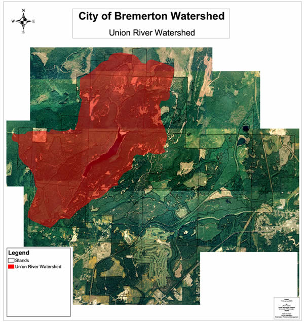
Union River Forestlands: The Water Utility
currently owns 2,777 acres in the Union
River drainage basin.
The Union
River Basin is heavily forested and the composition of
the
forest and vegetation is greatly influenced by previous
logging and fire history. Much of the timber is 50–60
years old. The Union River and minor creeks in the drainage
convey
water to the Union River Reservoir from which water is
drawn for municipal consumption. The primary goal of this
watershed
planning area is to maintain the present unfiltered status
of the surface water supply through meeting requirements
of federal and state regulations. The secondary goals include
forest health, annual timber revenues, and sustainable
volumes of harvestable timber supply. Constraints to timber
management
include surface water quality and treatment regulations,
other regulations such as state forest practice regulations,
current distributions of stand ages and characteristics,
spatial proximity of forest stands to reservoir/intakes,
topographical limitations on operations, and viewscape
concerns.
Other Lands: In 1997, based on GIS
analysis, the Water Utility estimated that PW&U lands
outside of the Union River Forestlands comprised 5,409 acres.
These lands are Gorst
Creek Drainage Basin (2892 acres), Heins Creek Drainage
Basin (435 acres), Anderson Creek Drainage Basin (347 acres),
and
other scattered parcels (1,735 acres). Within these drainages
are located 12 wells from which PW&U extracts 40% of
its available water supply. Since protection of surface
water is not as critical of a concern for this area, PW&U
has identified the generation of sustainable income from
timber
harvest activities as the primary management goal for these
forestlands. Forest health and transitional strategies
toward future sustainability of harvest volumes through
age class
distribution adjustments are important goals here as well.
Unique to this area is the practice of recycling biosolids
from the City wastewater treatment plant to produce soil
improvements and increased forest productivity while disposing
of wastewater. The City has estimated that its program
for the application of biosolids (currently on about 430
acres)
saves the City approximately $200,000 annually. Identified
to be considered, as management constraints on timber harvest
within these lands are regulations, stand characteristics,
financial needs/markets, the need for appropriate forest
conditions in adequate supply for use as biosolid application
sites, and concerns over viewscape quality.
Geographical Information Systems
Modern forest management planning processes
for the integration of multiple values that maximize prioritized
outputs
have been aided tremendously by developments in Geographical
Information System (GIS) technologies. Spatial issues
such
as road distributions,
stand inventory locations, stream buffers, sediment flows,
unstable slopes, wildlife habitat areas, and others can
be examined with unprecedented analytical capability.
The result
is more accurate predictability of environmental consequences
associated with management choices and subsequently greater
operational efficiencies. In this project, the RTI GIS
Specialist will work with PW&U to assemble all useful mapping layers
and orthophotos for virtual spatial analysis for the Bremerton
PW&U. This spatial database will be linked with inventory
information. Individual management unit polygons (stands)
will be delineated for all operationally unique areas located
within the two PW&U planning units (landscapes). Outputs
from growth and yield simulations for each planning period
and for selected proposed management alternatives will be
presented with spatial reference. All mapping capabilities
that are generated as part of this project will be made available
to the PW&U Forest Manager.
Landscape Management System
Suggested management alternatives will involve
in-depth analysis of specific consequences and tradeoffs
of
various management
actions. Management alternatives will need to be spatially
and temporally sensitive. It has been identified as
an important objective of the PW&U, for example, that harvest volumes
and revenues associated with timber management be sustainable
into the future. Estimation of such output flows through
time will require sophisticated modeling and analytical capabilities.
The Landscape Management System (LMS) has been developed
at the University of Washington for just this purpose. LMS
is a computerized system that integrates landscape level
spatial information, stand-level inventory data, and individual
tree growth models to project changes through time across
forested landscapes. LMS coordinates the execution and information
flow between many different computer programs (40+). These
programs: format, classify, summarize, and export information;
project tree growth and snag decay; manipulate stand inventories;
and present stand and landscape level visualization and graphics.
Portfolio Alternatives
The two virtual planning units, Union River Forestlands
and Other Lands, will be created as LMS “portfolios” which
will be made up of all stand polygon information associated
with each of the two planning units (landscape areas). RTI
staff will work with PW&U and other consultants to assemble
all needed data for the preparation of two LMS portfolios
for PW&U forestlands designated for investigation. Most
forest inventory information available for the study areas
is from fieldwork accomplished as part of the planning process
in 1996. This data will be “grown” forward used
the Pacific Northwest Variant of the Forest Vegetation Simulator
(FVS), a regional growth model. In areas where harvest activities
have occurred with the last six years some new inventory
data has been collected and will be used. Where inventory
data is found to be insufficient RTI staff will work with
PW&U to generate needed information. Two portfolios will
be created from which to develop alternative management approaches
for PW&U use. Upon completion of portfolio construction
for Union River Forestlands and Other Lands, RTI staff will
work with PW&U to develop and model alternative approaches
for the management of the two planning units for 50 years.
Outputs from the modeled alternatives will be presented in
5-year increments. These 5-year increments will be considered
as management cycles. Objectives of all management alternatives
to be developed for the two planning units will be reflective
of the stated objectives of the Water Utility. All alternatives
will be designed to protect City water quality and to meet
the requirements of all applicable laws. Differences in alternative
approaches will reflect a variety of strategies conceived
to maximize desired outputs within the operational opportunities
and constraints identified by the Water Utility. Alternatives
will be evaluated relative to metrics of economic and ecological
performance over time.
A market assessment of potential forest outputs will characterize
transitional issues required to reach sustainable levels
of income and harvest volumes as well as the ability to cover
management costs while producing reasonable returns to the
Utility. The economic activity produced by operations will
also support the local economy while contributing to improved
environmental amenities. Pertinent to examination of sustainable
timber harvest flows will be issues of age class distribution
and future land use conversion. Different estimations of
the impacts of these two issues will be incorporated into
the management alternatives.
Active management and rotation age adjustments can interact
to produce a shifting mosaic of forest conditions. Visualizations,
graphical analysis, and mapping imagery for each management
scenario will be made to aid Utility managers in determining
and understanding the consequences and/or tradeoffs of each
alternative.
Simulations of alternatives for comparison will be conducted
on 5-year growth cycles for a total planning period of 50
years. It is the suggestion of the project team that, in
the spirit of adaptive management, 5-year intervals are appropriate
periods of time to anticipate a need for revisitation of
all planning assumptions and output estimates. However, since
a goal of this project is to plan for a transition of activities
within the forestland base towards output levels of enduring
sustainability, a longer time frame than one growth cycle
is needed for strategic investigation. Fifty years was selected
as the planning cycle for this project to be representative
of the time interval from regeneration to final harvest for
an idealized forest stand within the watershed. Fifty years
is also a sufficient time period to begin to see the implications
of adjustments to age class distributions and species mixtures
to estimates of revenue and harvest flow sustainability.
Deliverables:
1) Preliminary and Final Report
2) All data and modeling outputs
3) Presentations by RTI staff to Utility personnel as requested


