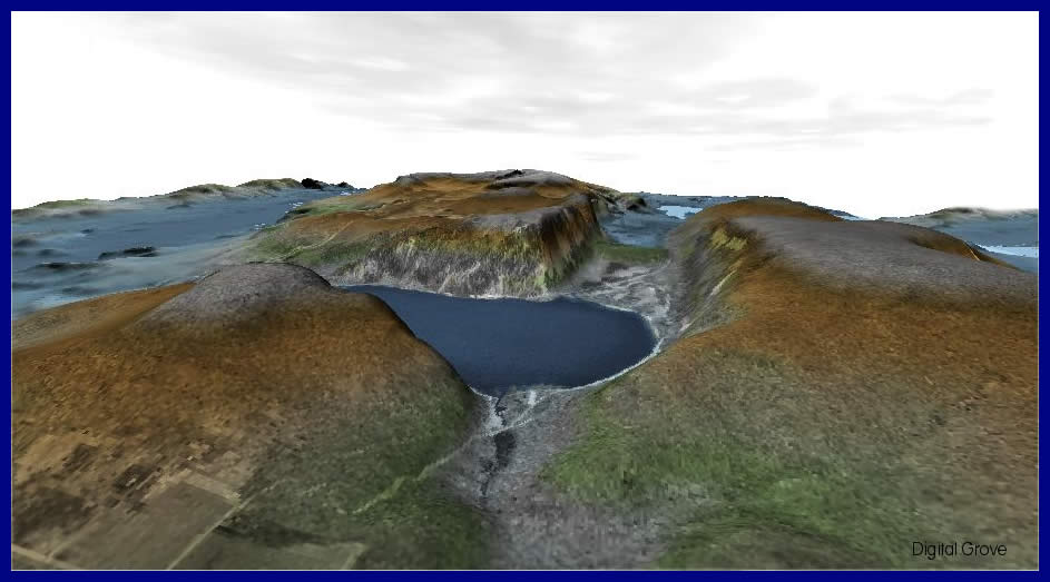
Devil's Lake was formed during the last Ice Age, which ended about 10,000 years ago. Vast ice sheets up to two miles in height advanced across Wisconsin. One lobe of the glacier reached its furthest extent here, wrapping around the facing 500-foot bluff. The terminal moraine of rock and gravel dumped by the glacier plugged what was once the channel of an ancient river. Devil's Lake formed where the channel was not filled with glacial debris.
This elevation map was made with Manifold System 5, a comprehensive GIS program. A 2D gray scale orthophoto was used as a transparent overlay on the terrain model generated from a 30-meter USGS DEM.