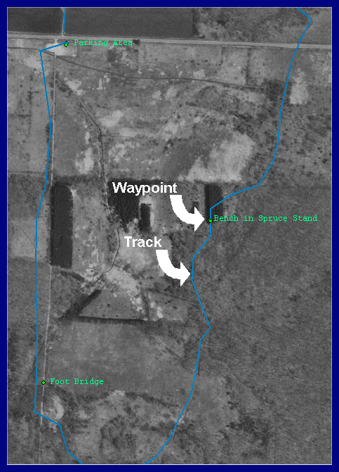
GPS units take track points "on the fly" at timed intervals. As a result, they are not precise. That is evident on the left side of the photo, where the actual path went up the woods road shown as a gray line. Dense tree foliage in August might also have been a factor for the variance.
The waypoints themselves are right on. If you want to map a trail, you should take a waypoint at each curve and not depend on the track record alone.
To get accurate waypoints, pause to get at least four good satellite readings, then click the point. Take care to hold the unit away from you to avoid blocking the satellite signals with your body.